The little squiggles are necessary to ensure election outcomes acceptable to the ultra rich.
I’m joking. (Mostly)
The squiggles are probably county line divisions, and probably simply the smallest existing land divisions with good population data available to make the map from.
I say “mostly joking” because existing county line divisions are already weird in some cases, to ensure election outcomes acceptable to the ultra rich. So there’s an unpleasant grain of truth in my joke.
It may be zip code boundaries, given how narrow the NYC strip is. Some of the excessive jankiness in what was Nevada would be because no one lives on a lot of the federally-owned land reserves out there, so they don’t get their own post office, and the catchment area of some zip codes gets huge with weird boundaries.

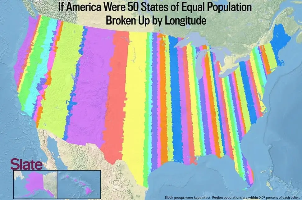
Wonder how the little squiggles would affect things if it was straight longitudinal lines
The little squiggles are necessary to ensure election outcomes acceptable to the ultra rich.
I’m joking. (Mostly)
The squiggles are probably county line divisions, and probably simply the smallest existing land divisions with good population data available to make the map from.
I say “mostly joking” because existing county line divisions are already weird in some cases, to ensure election outcomes acceptable to the ultra rich. So there’s an unpleasant grain of truth in my joke.
It may be zip code boundaries, given how narrow the NYC strip is. Some of the excessive jankiness in what was Nevada would be because no one lives on a lot of the federally-owned land reserves out there, so they don’t get their own post office, and the catchment area of some zip codes gets huge with weird boundaries.